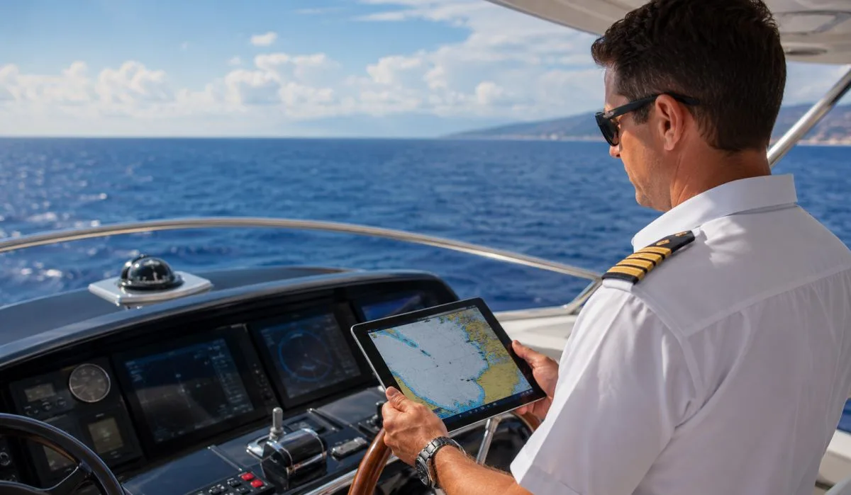
When you take your yacht out on the water, you need two things. You need to know where you are going. And you need to stay safe. Your phone or tablet can help you do both. But you cannot use just any map app. You need apps made for boats.
This article lists the best yacht apps for navigation and safety. We also cover the best yacht apps for navigation and safety android and best yacht apps for navigation and safety iphone. And we tell you about the best free marine navigation app for android.
Why You Need a Special App for Your Yacht?
Driving a yacht is not like driving a car. On the road, Google Maps works well. On the water, there are no street names. There are no traffic lights. There are rocks under the water. There are shallow areas where your boat can get stuck. There are other boats. There is weather that changes fast.
A good yacht app shows you water depth. It shows you marks that help you stay on course. It shows you where other boats are. It also lets you save maps to your phone so you can see them when you have no internet. That is very important because many places on the water have no phone signal.
Read More: Difference Between a Yacht and a Boat: Size, Use, Cost Guide
What to Look For in a Yacht App?
Before we list the apps, let us talk about what makes an app good for a yacht.
- First, the app must have offline charts. You download the map before you leave. Then you do not need the internet to see it.
- Second, the app must show depth. This tells you if the water is deep enough for your boat.
- Third, the app must show aids to navigation. These are buoys and other markers that tell you where it is safe to go.
- Fourth, the app must have a way to track where you have been. This is called a track. It helps you go back the same way.
- Fifth, the app must update your position quickly. It uses the GPS in your phone or tablet.
Now let us look at the best apps one by one.
Navionics
Navionics is one of the most trusted names for boat navigation. Many yacht owners use it. The app works on both android and iphone. It is not free. But many people say it is worth the money.
When you open Navionics, you see a clear map of the water around you. The map shows depth numbers. You can see where the water is deep and where it is shallow. This helps you avoid running your boat onto a sandbar or a rock.
Navionics also has a feature called SonarChart. This is a map made by other boaters who use the app. They send depth information as they go. Navionics puts that information together to make a very detailed map. This map shows small changes in the water bottom that other maps miss.
For safety, Navionics lets you mark dangers. You can put a pin on a rock or a wreck. The app also shows you the path of other boats if they share their location. But the main safety feature is the depth alarm. You tell the app at what depth you want to be warned. If the water gets that shallow, the app makes a sound.
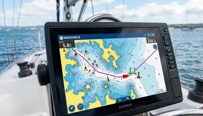
Navionics also gives you weather information. You can see wind speed and direction. You can see wave height. You can see if a storm is coming.
The offline feature works well. You choose an area of the map and download it to your phone. You can do this before you leave your home or marina. Then when you are on the water with no signal, the map still works.
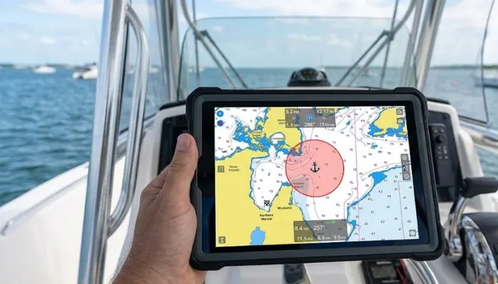
Aqua Map
Aqua Map is another strong choice. It is known for being very easy to use. The map is clean. There is no extra clutter on the screen. This matters when you are driving a boat and need to see things fast.
The app uses government charts. In the United States, these come from the NOAA. These charts are very accurate. They are the same charts that big ships use.
Aqua Map has a great feature for anchoring. You drop your anchor. Then you tell the app that you are anchored. The app draws a circle on the map. The circle shows how much room your boat needs to swing without hitting anything. If your boat moves outside that circle, the app sends an alarm. This tells you that your anchor might be dragging. That is a big safety feature. A dragging anchor can put you on the rocks while you sleep.
The app also connects to some boat instruments. If you have a device that sends depth or wind data, Aqua Map can show that data on the screen. But you do not need those extra devices. The app works fine with just your phone or tablet.
For offline use, Aqua Map lets you download charts for any area. You can download a whole state or a whole country. The downloads are large but worth it.
Aqua Map is not free. But the price is low compared to a boat crash.
SeaPilot
SeaPilot is made for people who want an app that looks like a car GPS. The screen shows your boat as a triangle. The map moves as you move. You see turns ahead. This is good for new boaters.
SeaPilot has a route planner. You tell the app where you want to go. The app draws a line on the water. It keeps the line in deep water. It stays away from rocks and shallow areas. Then you just follow the line.
The app also shows marinas and fuel docks. It shows restaurants on the water. It shows bridges and tells you how high they are. If your boat has a tall mast, you need to know bridge heights.
For safety, SeaPilot has a man overboard button. If someone falls off the boat, you press this button. The app saves that spot. Then it helps you drive back to that exact spot. This saves time. Every second matters when someone is in the water.
SeaPilot works on android and iphone. It has a free version. The free version has ads and fewer maps. The paid version is better for serious boaters.
C-Map Embark
C-Map Embark is another strong app. It is made by the same company that makes Navionics. But the two apps work a little differently.
C-Map is good for trip planning. You can sit at your table at home and plan your whole trip. You add stops. You see how long each part of the trip takes. You see how much fuel you will use. Then you save the trip. When you get on the boat, you open the app and follow your plan.
The maps in C-Map are very clear. Depth numbers are easy to read. The app also shows tide and current information. This is important because water moves. A current can push you off course. A tide can make a place too shallow to enter.
For safety, C-Map has a feature called weather overlay. You see the weather on top of the map. You can see where rain is. You can see where wind is strong. You can change your route to stay away from bad weather.
C-Map Embark is free to download. But many maps and features require a paid subscription.
Best Yacht Apps for Navigation and Safety Android
If you have an android phone or tablet, here are the best choices.
- Navionics works great on android. The app runs smooth. The maps load fast. The GPS on most android phones is very good. So Navionics knows exactly where you are.
- Aqua Map also works well on android. The app is light. It does not use too much battery. This matters on a long day on the water.
- SeaPilot is another good android choice. It is simple. You do not need to read a long manual. You open the app and start using it.
Another app for android only is Marine Navigator. It is not as famous as Navionics. But it works. It uses NOAA charts. The app lets you measure distance on the map. It lets you add your own marks. It is good for boaters who do not need extra features.
So for android users, start with Navionics. If you want something simpler, try SeaPilot. If you want to save money, try Marine Navigator.
Best Yacht Apps for Navigation and Safety iPhone
iPhone users have many good choices too.
Navionics is just as good on iphone as on android. The screen on the iphone is bright. The colors on the map look good. The app uses less battery on iphone than some other navigation apps.
Aqua Map on iphone is very smooth. The pinch to zoom works fast. The alarm for anchor drag works well.
There is also an app called iNavX. It is older than the others. But it is still good. iNavX uses the same NOAA charts as Aqua Map. It has many tools for serious boaters. You can connect it to your boat's autopilot and radar. But for most people, iNavX is more than they need.
So for iphone, the best choices are Navionics and Aqua Map.
Best Free Marine Navigation App for Android
Not everyone wants to pay for an app. That is okay. You can still get a good free app.
- The best free marine navigation app for android is Marine Navigator. As we said before, it is not as full featured as Navionics. But it is free. And it works.
- You download Marine Navigator from the google play store. When you open it, you see a map of your area. The map shows depth. It shows buoys. It shows markers.
- The free version of Marine Navigator has all the basic tools. You can see where you are. You can see where you have been. You can save spots. You can measure distance.
There are ads in the free version. They do not get in the way too much. They show at the bottom of the screen.
- Another free app is US Topo Maps. This app is for hiking and boating. It shows the land and the water. It is not as good as Marine Navigator for pure boating. But it works in a pinch.
- One warning about free apps. They often do not have all the safety features. They might not have depth alarms. They might not have man overboard buttons. So if you use a free app, be extra careful. Look at your depth often. Watch the weather.
If you go out often, it is worth paying for Navionics or Aqua Map. But for a trip once a year, the best free marine navigation app for android will work.
How to Use These Apps Safely?
An app is a tool. It helps you. But it does not replace your eyes and your brain.
- Always look at the water. Do not stare at your phone screen. The water tells you things. You can see waves. You can see color changes that mean shallow water. You can see other boats.
- Keep your phone charged. Bring a backup power bank. A dead phone on the water is no help at all.
- Bring a paper map too. Paper maps do not run out of battery. They do not break when they get wet. Keep a paper map in a dry bag.
- Tell someone on land where you are going. Tell them when you will be back. If you do not come back, they can call for help.
Do not trust the app completely. Sometimes the GPS is wrong. Sometimes the map has a mistake. If the app says the water is deep but it looks shallow, slow down. Check with a physical depth finder if you have one.
You May Also Read: How Much Does It Cost to Charter a Yacht – Full Price Guide
Putting It All Together
You do not need to download ten apps. You need one good app that you know how to use.
For most yacht owners, the best choice is Navionics. It has clear maps. It has good depth information. It has weather. It has safety alarms. It works on android and iphone.
- If you want something simpler, choose Aqua Map. It is clean. It is easy. The anchor alarm is very good.
- If you want a free app on android, choose Marine Navigator. It is the best free marine navigation app for android.
- If you have an iphone and want the best, stick with Navionics or Aqua Map.
Remember to download your maps before you leave. Test the app at your dock. Make sure the GPS sees your position. Show someone else on your boat how to use the app. That way if something happens to you, they can still navigate.
The water is a beautiful place. But it can be dangerous. A good app helps you stay safe. It helps you avoid rocks. It helps you see the weather coming. It helps you get home when fog rolls in. Choose one app from this list. Learn it. Use it. And have a safe trip on your yacht.